The images below are a selection of high resolution scans of historical maps from the Greater West Bloomfield Historical Society’s collection. Click on the text links below or scroll down to open the maps and see more detail. High quality prints of some of these maps are available for purchase in the Orchard Lake Museum Store.
West Bloomfield
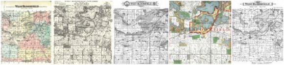
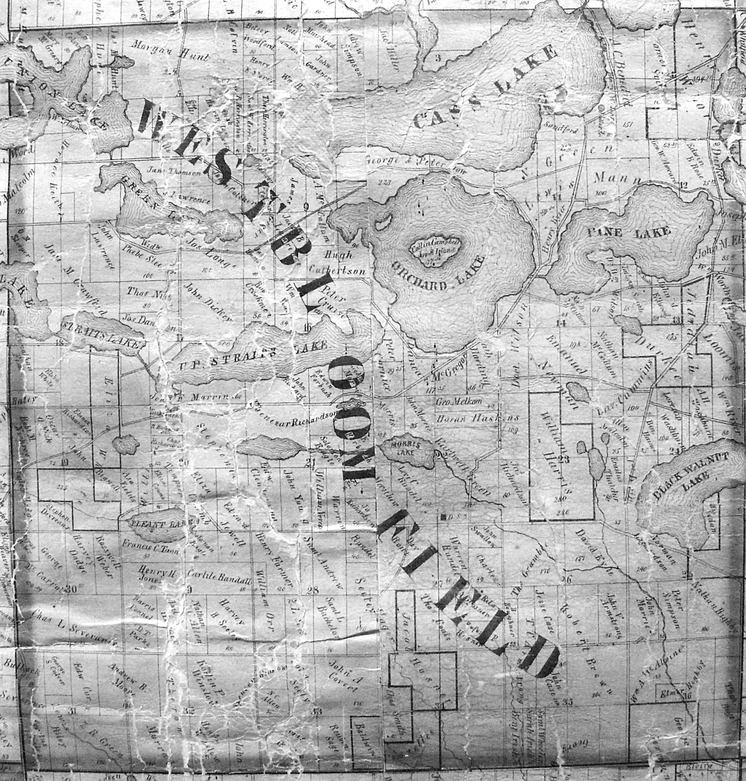
West Bloomfield Map 1857
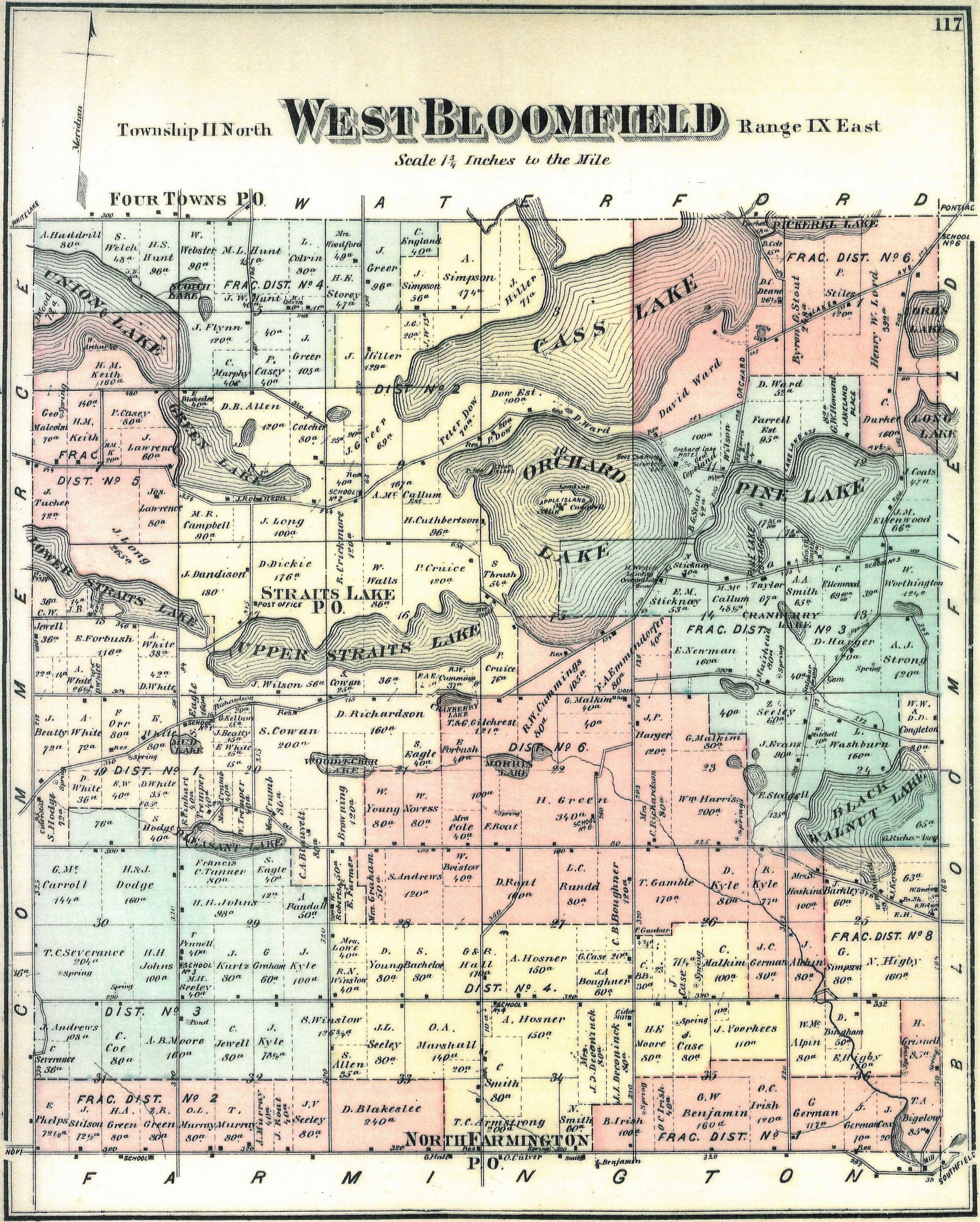
West Bloomfield Map 1872
West Bloomfield Map 1896
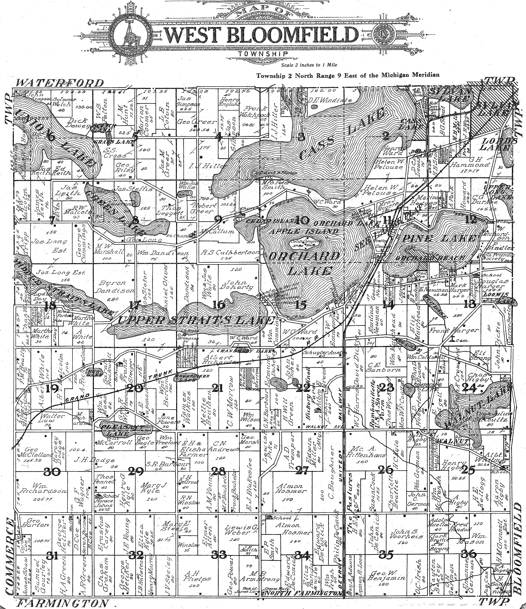
West Bloomfield Map 1908
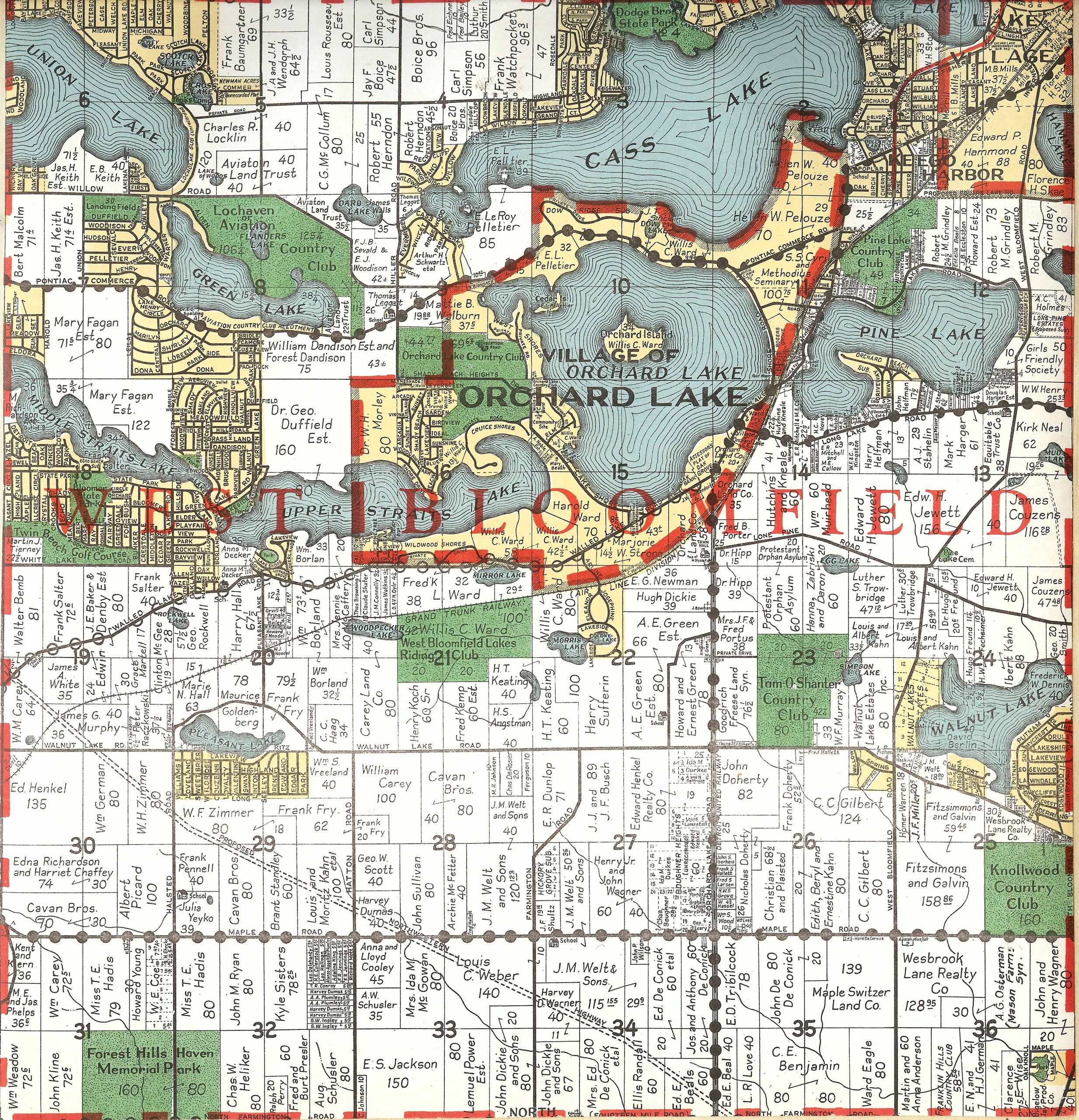
West Bloomfield Map 1930
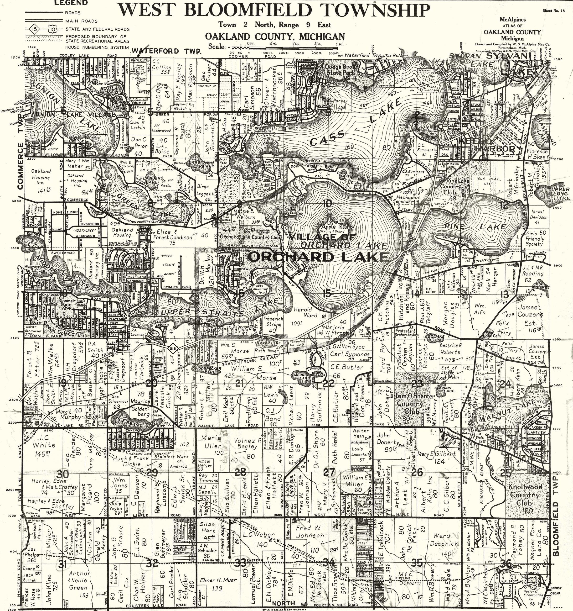
West Bloomfield Map 1947
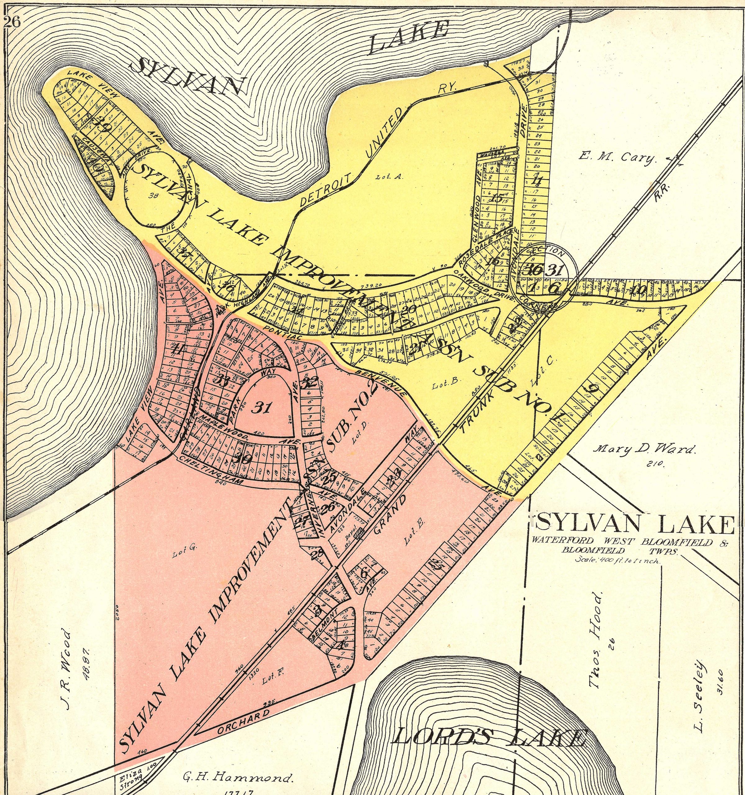
Sylvan Lake
West Bloomfield Map 1857
West Bloomfield Map 1872
West Bloomfield Map 1896
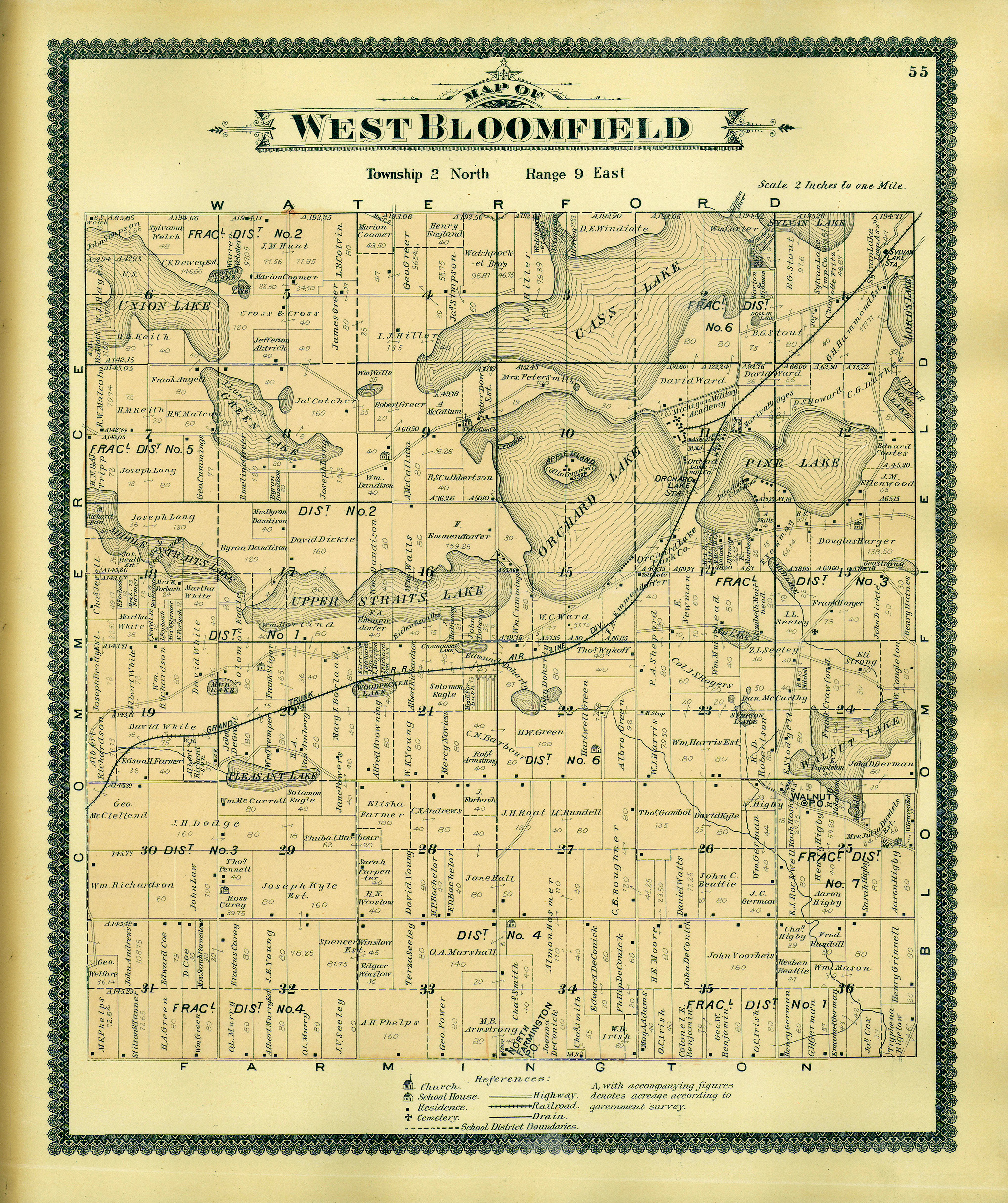
West Bloomfield Map 1908
Sylvan Lake Map 1908
West Bloomfield Map 1930
West Bloomfield Map 1947